Drone Surveying in Johnson County TX and Cleburne TX
Trans Texas Surveying and Mapping is your trusted provider of drone surveying services in Cleburne, TX, and Johnson County, TX.
In addition, our advanced drone technology provides accurate, detailed mapping and surveying data. As a result, we are able to offer high-quality solutions to a variety of industries, including construction, real estate, environmental analysis, and infrastructure projects.
Why Choose Drone Surveying in Cleburne, TX?
Aerial mapping offers significant advantages over traditional methods, especially for projects in Cleburne, TX, and Johnson County, TX. In particular, using advanced UAV technology, drone surveys provide faster, more accurate, and cost-effective data collection. Additionally, they minimize environmental impact.
Whether you’re surveying large plots of land, construction sites, or difficult-to-reach areas, our aerial services deliver high-quality results. As a result, there is less disruption and greater efficiency.
Faster Data Collection
Enhanced Accuracy
Cost Effective
Access to Hard-to-Reach Areas
Minimal Environmental Impact
Benefits of Drone Surveying and Aerial Mapping on Your Business
Whether you’re in construction, real estate, or agriculture, UAV surveys offer valuable insights to improve your operations. In addition, they collect high-resolution geospatial data quickly and accurately. As a result, they are essential in various fields.
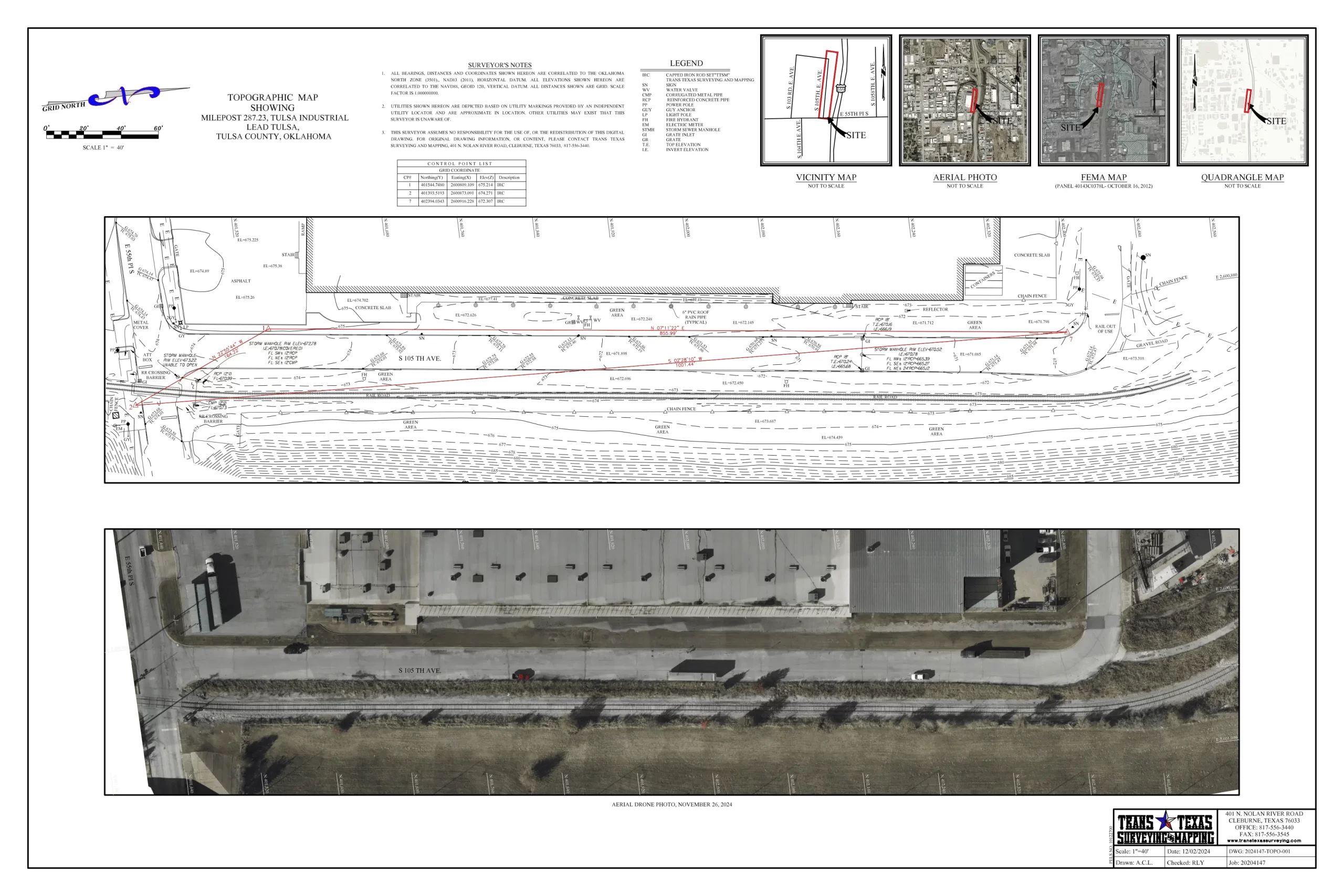
Engineering Drone Surveys
Topographical data from drones enhances site analysis, infrastructure design, and construction accuracy.
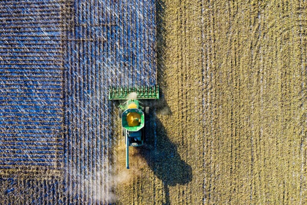
Agricultural Drone Surveys
Drones monitor crop health, field conditions, and irrigation, supporting sustainable and efficient farming.
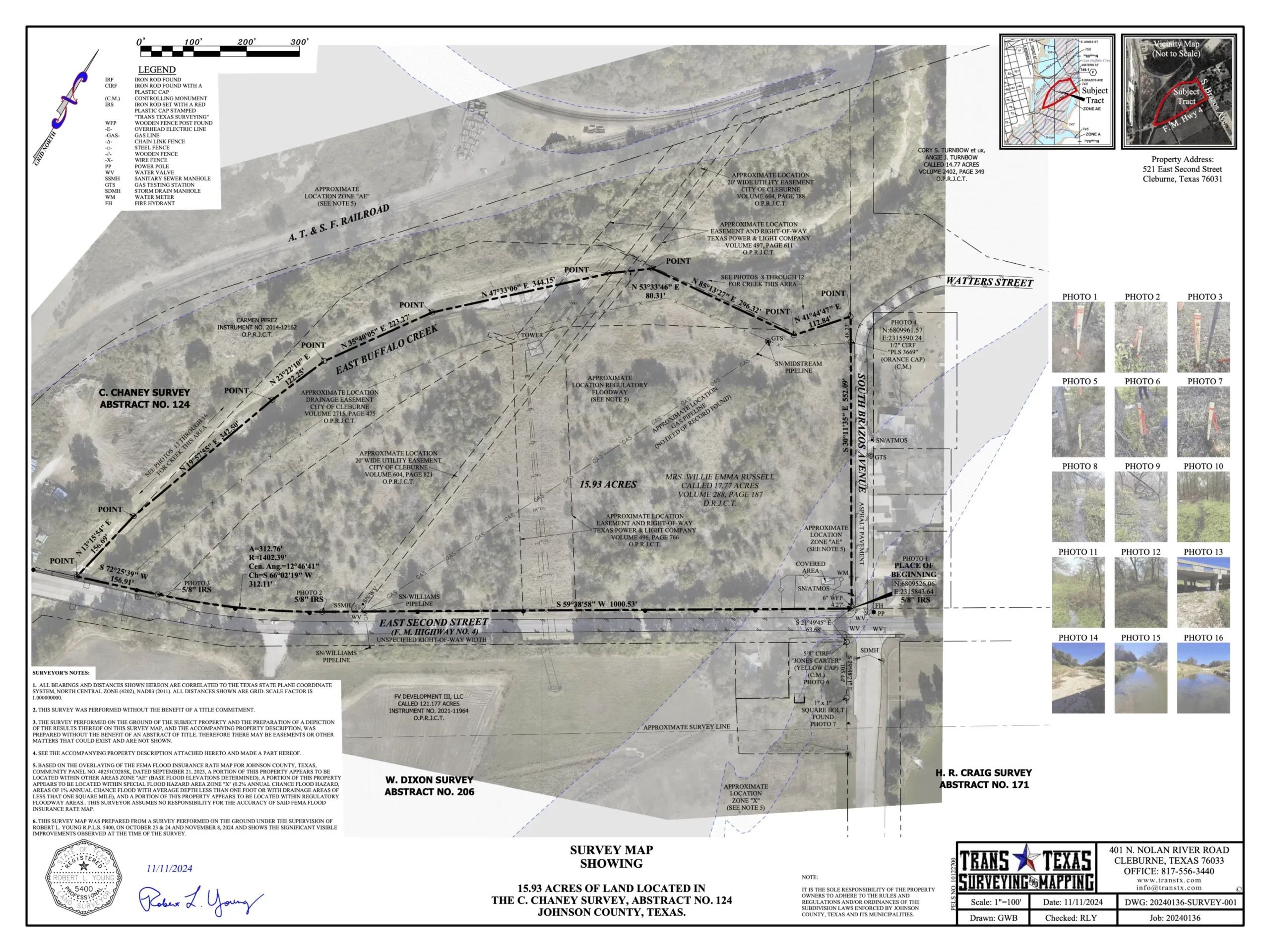
Environmental Drone Surveys
Drones map ecosystems, track landscape changes, and aid conservation with minimal habitat disruption.
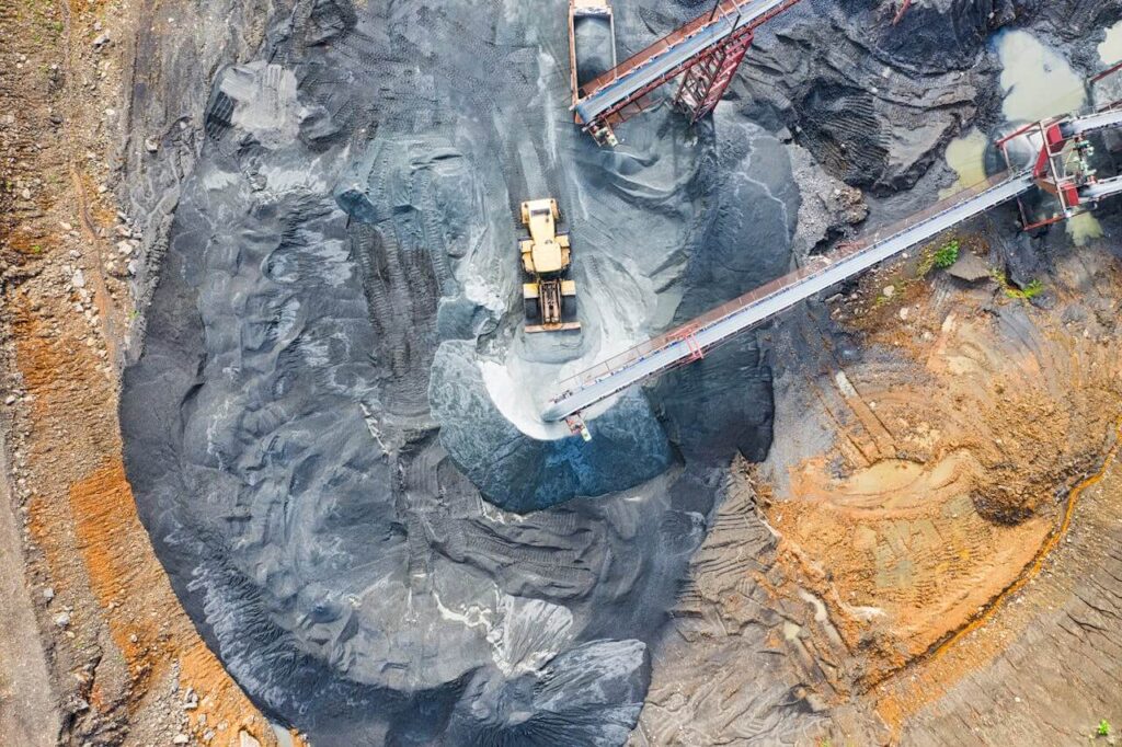
Mining Drone Surveys
Drone surveys deliver precise maps of mining sites, improving resource planning, hazard detection, and inventory tracking.
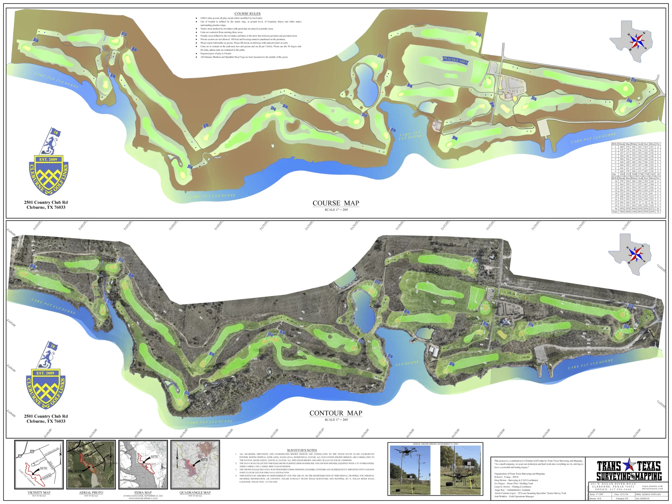
Real Estate Drone Surveys
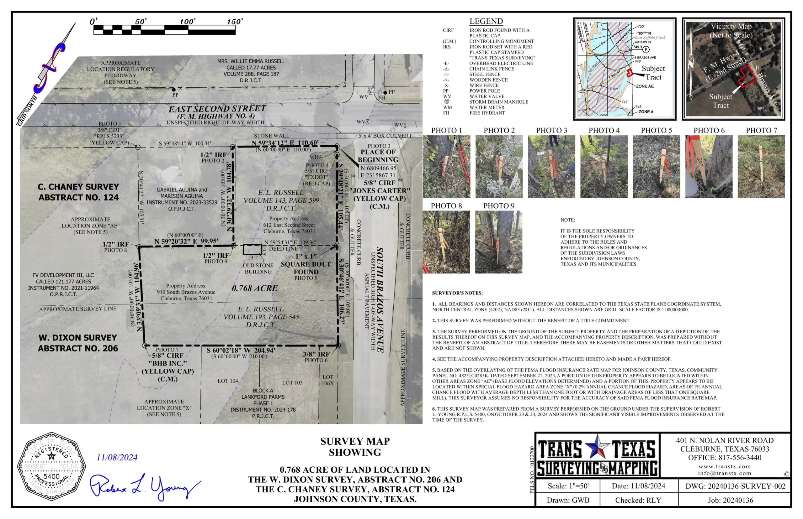
Drones provide detailed imagery and terrain data, helping showcase properties and plan developments effectively.
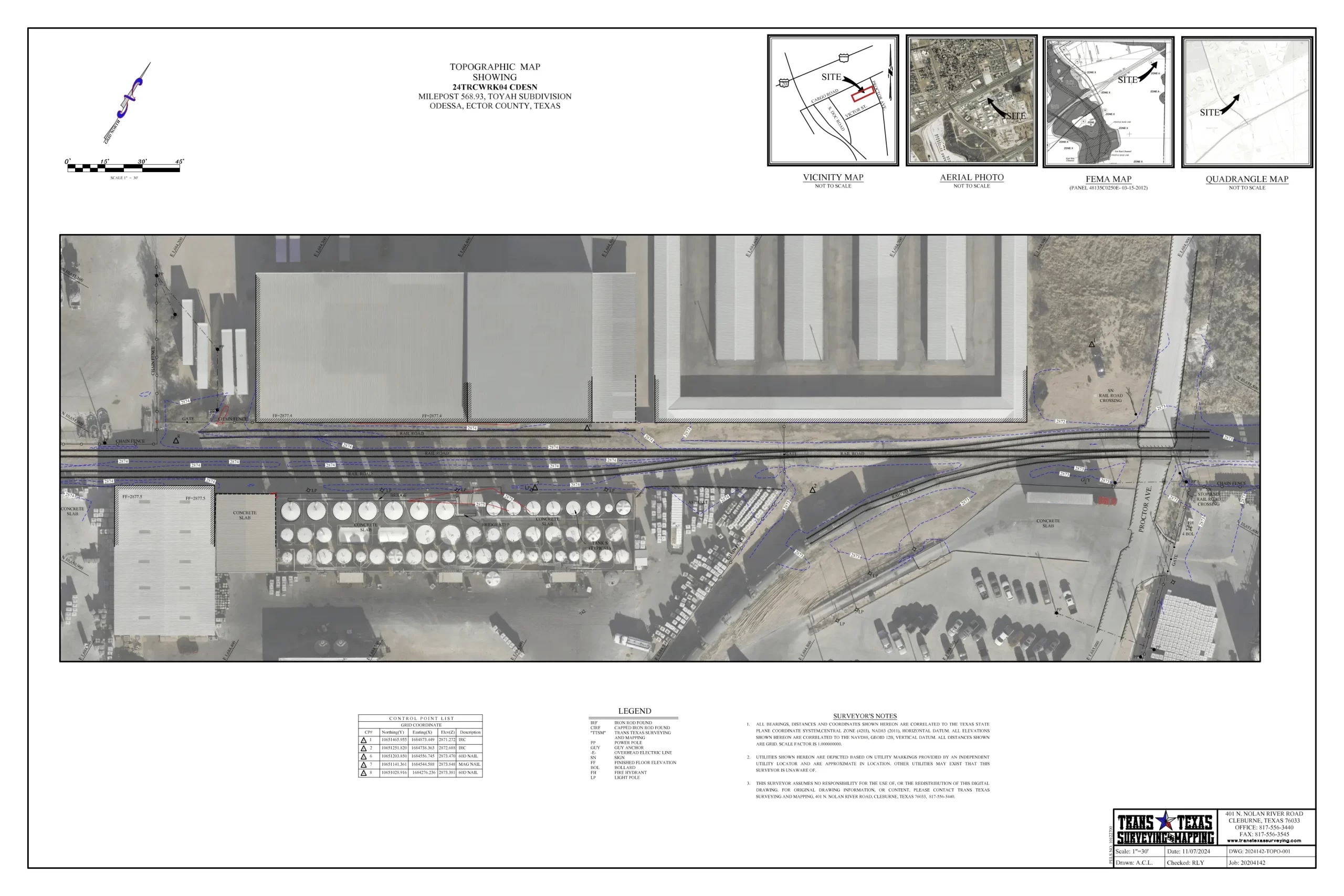
Infrastructural Drone Surveys
Drone surveys optimize infrastructure projects by improving planning, progress tracking, and issue detection.
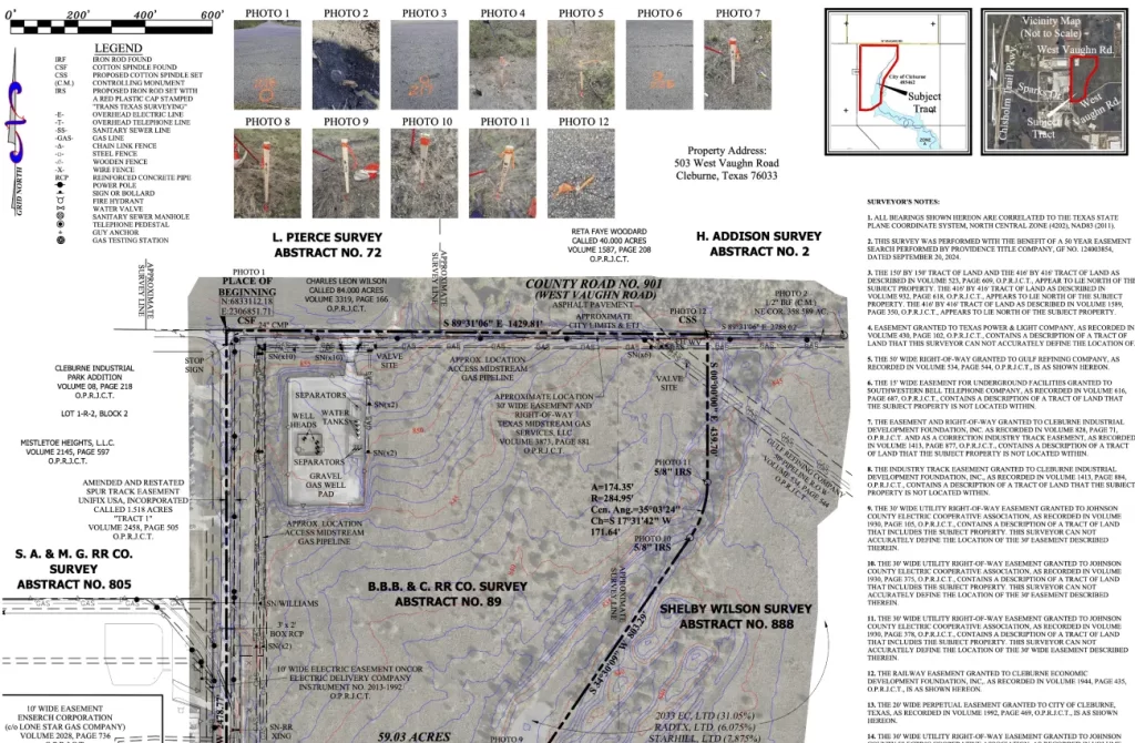
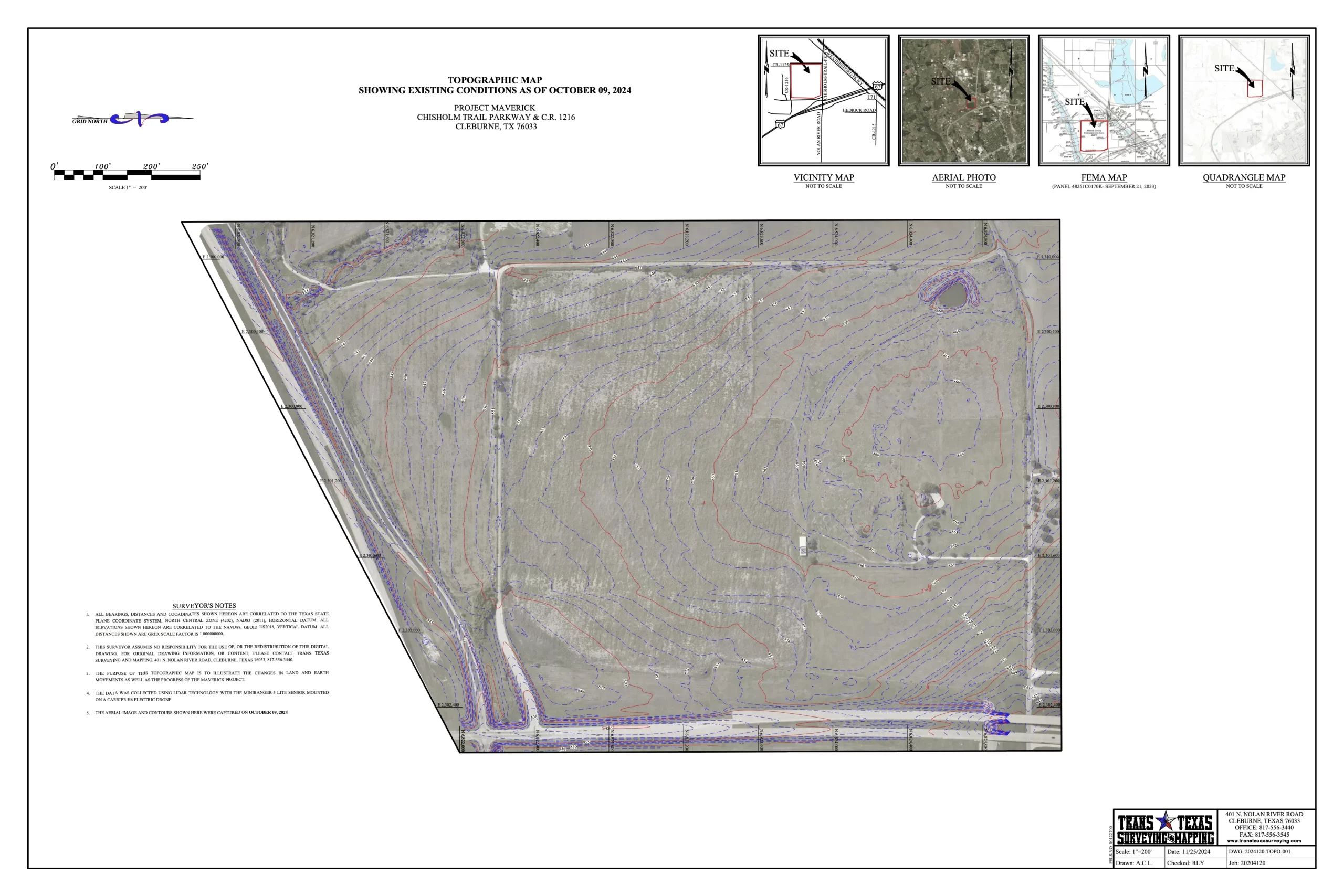
We Use Industry-Leading Technology for LiDAR Drone Surveys
Precision in the Sky
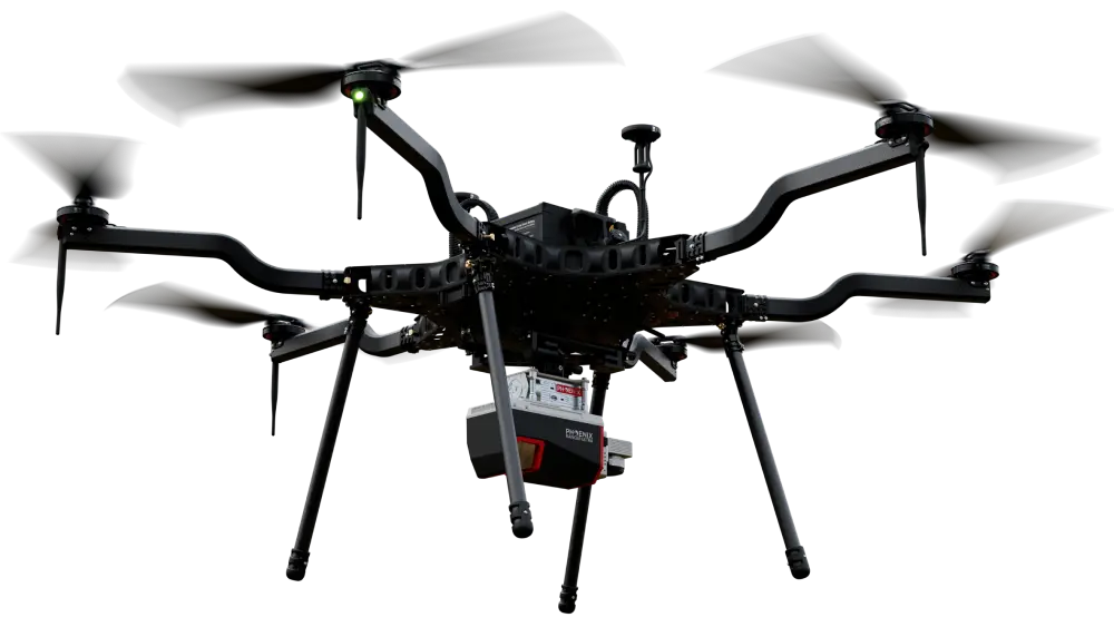
The Harris H6 Electric drone sets the standard for professional drone surveys. Its powerful electric motor and advanced stability features allow for precise aerial mapping across diverse terrains. With extended flight times and exceptional reliability, the Harris H6 ensures accurate data collection, making it a trusted choice for drone surveyors seeking efficient and detailed results.
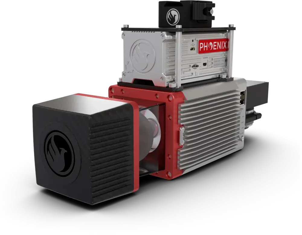
Superior LiDAR Technology
Equipped with RIEGL technology, the Phoenix MiniRANGER-3 Lite delivers superior performance for aerial LiDAR surveys. This state-of-the-art LiDAR sensor captures high-resolution geospatial data with unmatched accuracy, even in complex landscapes. Perfect for industries relying on precise topographical data, it sets our drone survey services apart from the competition.
Serving Cleburne, TX and Johnson County, TX
At Trans Texas Surveying and Mapping, we are proud to serve Cleburne, TX, and all of Johnson County, TX with professional drone services. Whether you’re in the heart of Cleburne, the surrounding rural areas, or throughout the county, our team is ready to assist you.
We understand the unique requirements of local industries. As a result, we are committed to providing fast, reliable, and accurate drone solutions. From residential developments to large infrastructure projects, our team has the expertise and technology to deliver exceptional results on time and within budget.
Why Choose Trans Texas Surveying and Mapping?
Experienced Professionals
We deliver trusted results by combining years of experience with cutting edge drone technology.
Cutting Edge Equipment
We use the latest UAV technology and high-resolution sensors to ensure highest quality surveys.
Local Knowledge
As a locally owned business serving Johnson County TX, we understand the needs of local projects.
Customer-Focused Approach
We want to understand your needs to deliver tailored surveys that exceed expectations.
Ready to take your project to the next level with accurate, efficient, and cost-effective drone services? Contact Trans Texas Surveying and Mapping today to discuss your needs and get a free, no-obligation quote.
If you have any questions or are interested in our services, please call our office (817-556-3440) or use the button below to fill out our contact form.