
The measurements have changed. The obligation to understand and preserve them has not.
I can remember when a field book was the center of a survey job. You might have an instrument, a chain, a crew, a sketch and a whole lot of ground to cover, but when the day was over, somebody had to put the observations into a record another person could understand.
Today we can collect millions of three-dimensional points and bring them into the office as a point cloud. We can rotate the site on a screen, inspect a wall we scanned last week, build a terrain surface and move information into CAD or GIS without drawing every line by hand.
That is extraordinary progress. I have enjoyed watching it happen. But I still ask the same question I would have asked about a page of field notes nearly fifty years ago: Where did these measurements come from, and can somebody else check them?
The Field Book Was More Than Paper
I got my start through Sunday school. Harold Keeton was my Sunday school teacher, and in 1977, fresh out of college, I went to work for him and his son Stephen at Keeton Surveying Co. in Grand Prairie. I started as a chainman and brush cutter. They taught me chain measurement, transit work, field notes, traverse closures and how to weigh evidence. Both of them worked in the field and the office.
Harold was a huge mountain of a man, and he did not speak much. He showed me what to do and expected me to catch on, and I did. There was not a lot of talking, but there was a lot of work and a lot of redundant measurements every day. They taught that we must measure accurately and carefully, and repeat the process to reduce errors. All measurements have error. We are human.
Years later, I met with Stephen’s son Luke, who now runs the company with his sister Stephanie. Luke shared historical Keeton surveying records with me, with his permission. Those pages are not necessarily notes I personally wrote. They are a connection to the people who taught me and to the way the work was documented.
Some of those sheets contain handwritten observations, calculations and sketches. They remind me how much information could live on one page. The numbers mattered, but so did the marks, notes and relationships around them.
A good field sketch did something a column of numbers could not do by itself. It helped explain what the crew was looking at. A notation beside a point could help the next person understand whether the number came from an observation, a calculation or something that needed another look.
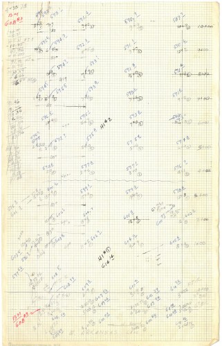
Figure 1. Handwritten survey notes preserved in the Keeton Surveying records and shared by Luke Keeton. The source scan is filed under a 1979 name; the page’s author and specific job have not been independently verified.
I do not want to romanticize the old days. Handwritten notes could be hard to read. A mistake in reduction could travel into the drawing. And there was plenty of work we did then that modern equipment does much faster and better. But the field book forced us to remember that a measurement has a history.
Then the Numbers Started Arriving Faster
I remember seeing one of the early electronic distance meters when we were still doing plenty of conventional measuring. It was a big orange instrument, and it made a strong impression on me. Here was a distance we once worked hard to obtain, now coming back electronically.
After that came more electronic instruments, computers, GPS and then GNSS, data collectors, robotic total stations, laser scanners, aerial LiDAR and drone mapping. Each advance increased the amount of information we could gather or the speed at which we could work with it.
We moved more of the field book into digital files.
A Point Cloud Is Not a Finished Survey
A point cloud is a remarkable record of measured surfaces. Depending on the sensor and the assignment, it may capture ground, pavement, walls, pipes, trees, equipment and structures in three dimensions. That is far more information than a crew could have booked point by point in the old days.
But a million points do not tell us automatically which ones represent the ground we need, whether a hidden feature was observed, what control was used, or whether the entire dataset is in the right reference system. The cloud may be dense and visually convincing while still requiring careful classification, independent checks and professional interpretation.
And a point cloud cannot settle a property boundary merely by showing where a fence stands. The surveyor still has to examine the records, monuments and other evidence and decide what the measurements mean.
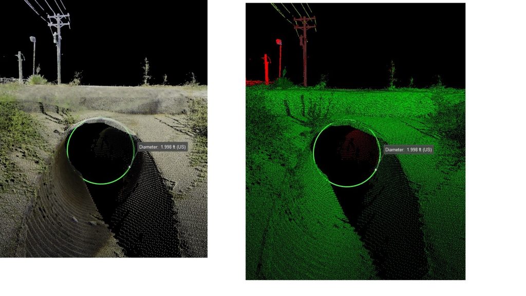
Figure 2. Cleburne culvert—two point-cloud display treatments of the same culvert opening, with an on-screen diameter measurement of 1.998 U.S. survey feet. The displayed measurement illustrates an extraction from scan data; its accuracy must be established from project control and checking, not from the image alone.
The Modern Field Book Has More Pages Than Ever
At TTSM, a digital survey record may include GNSS observations, instrument files, control reports, photographs, scan registration, LiDAR trajectories, classified point clouds, CAD linework and the finished deliverable. If those pieces stay connected, they can tell a very good story of the work.
If they get separated, we can end up with a beautiful file and very little understanding of how it was produced.
Think about a point-cloud processor receiving a large dataset. The processor needs to know the intended surface, the coordinate system and vertical reference, which points were control and which were checks, what the field crew could not see, and what processing decisions were made. Without that context, it becomes easy to mistake a smooth result for a dependable result. As Article 10 discussed, the coordinate system, datum and units are part of the deliverable.
That is why I want the original observations and source files preserved. If a cloud is filtered, classified, shifted, registered or transformed, document what happened. Keep enough information that the next person can reproduce the work or explain why it differs from another dataset.
The Field Crew Still Knows Things the Computer Does Not
A field person may know why a corner was not occupied, why a culvert invert needed a separate shot, or why the scanner could not see behind a structure. That knowledge needs to travel back to the office. A photograph, sketch or voice note can be just as important to the person building the model as another thousand points.
This is where I believe we can do better. Give the field crew the scope and the reference information before they leave. Have them check the control. Let them document what they found and what they could not find. Then give the office both the measurements and the story of the measurements.
A field book used to make that story visible on paper. Today we have to make a deliberate effort to preserve it across software and file formats.
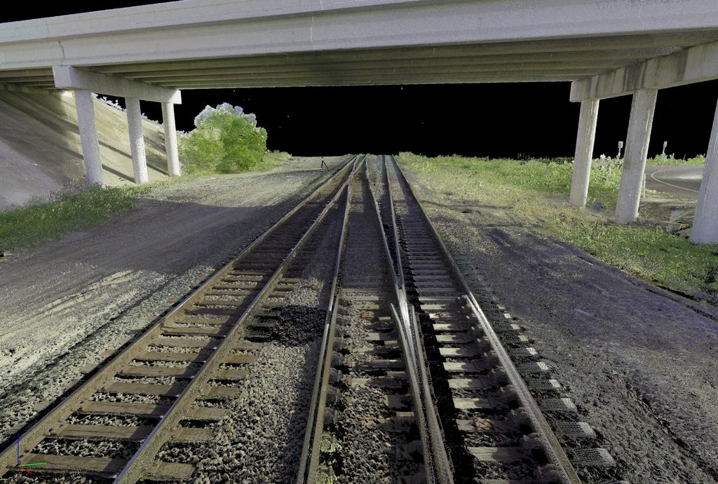
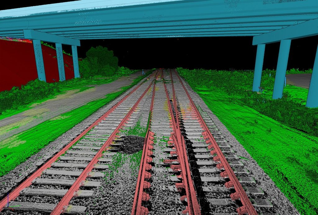
Figure 3. Cleburne railroad underpass viewed through two point-cloud renderings. The scan display and classified display help visualize the rails, ties, embankment and bridge from the measured dataset. These are digital views, not independent site photographs; the project reference and quality checks remain essential.
GIS Makes the Record More Useful
GIS can connect the finished measurements to parcels, assets, utilities, imagery, infrastructure and history. It lets people search and use geographic information long after the original crew has left the site. That is a tremendous benefit, especially for owners and communities managing information over decades.
But the GIS layer needs to carry its limitations with it. A general asset location does not always need survey-grade positioning. A utility conflict, construction layout or boundary decision may demand something very different. The person using the data should know the source, reference framework, date, intended use and appropriate level of confidence.
That is how GIS and professional surveying become stronger together: GIS helps information survive and reach more people; surveying supplies the measured foundation and professional judgment when the decision requires it.
Do Not Lose the Story Behind the Point
The old field book and the modern point cloud may look like opposites. One fits in a pocket. The other may take an entire drive to store. But both are records of someone trying to understand and measure the physical world.
I want the next generation of surveyors to take full advantage of the technology. Use the scanners. Fly the drones. Work with the point clouds. Build the GIS. Just do not let the volume of data convince you that the questions have gone away.
What did we observe? What was it referenced to? What did we check? What did we decide? And can somebody follow our work after we are gone?
The tools changed dramatically. The professional obligation did not.
KEEP THE OBSERVATIONS. PRESERVE THE CONTEXT. CHECK THE CONTROL. GET IT SURVEYED.
Robert L. Young, RPLS 5400 | Trans Texas Surveying & Mapping | www.transtx.com
GIS — Get It Surveyed™ | A Robert L. Young Educational and Book Series
© 2026 Robert L. Young. All rights reserved. Reproduction or distribution requires written permission, except as permitted by law.