

I have practiced land surveying long enough to see our profession transformed by technology.
When I began, we measured distances with chains and steel tapes, turned angles with transits and theodolites, ran levels, recorded observations in field books, and performed calculations manually.
Today we use GNSS, robotic total stations, drones, LiDAR, point clouds and digital twins. We can collect more information in a few hours than earlier survey crews could collect in days.
The technology changed. The fundamentals didn’t.
From a 1979 Topographic Survey to a Digital Twin
The 1979 topographic survey shown below was completed using the analog field and office equipment available at the time. Yet its purpose was remarkably similar to what we accomplish with today’s digital technology: measure the real world and create a useful representation of it.
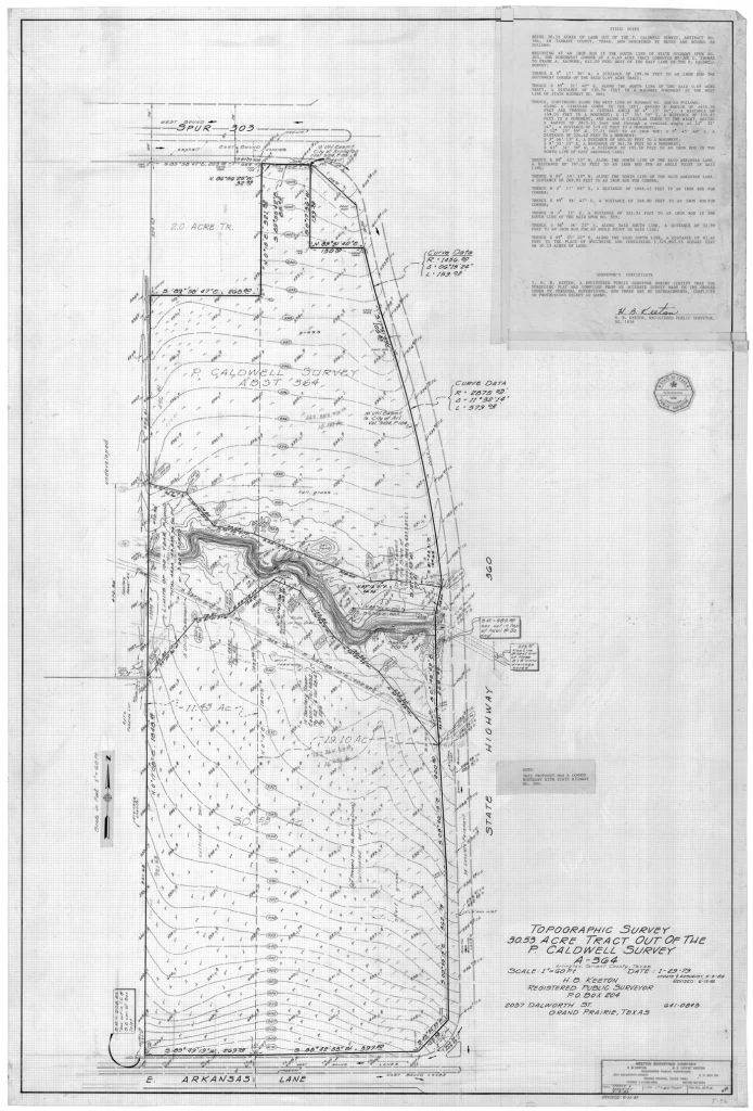
1979 topographic and boundary survey produced with analog field and office equipment. Contours transformed field measurements into a representation of three-dimensional terrain.
We certainly didn’t call it a digital twin in 1979. But the fundamental objective was much the same. Today, LiDAR can capture millions or billions of XYZ points and create an extraordinarily detailed three-dimensional representation of the physical world.
The amount of information has changed dramatically. The responsibility for its accuracy has not.
Digital Surveying Changed Everything
GNSS, robotic total stations, drones and LiDAR give today’s surveyor capabilities we could barely have imagined. Modern systems can capture complex infrastructure quickly and in remarkable detail.
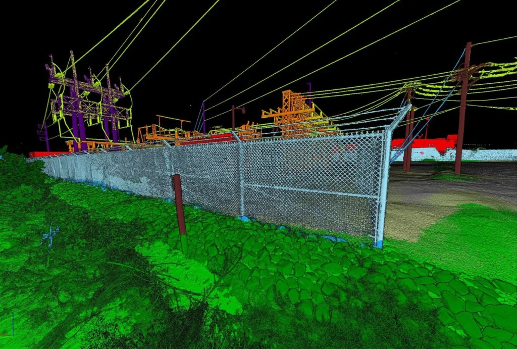
A modern LiDAR point cloud captures an extraordinary amount of three-dimensional information. More data does not remove the need for control and verification.
Precision Is Not Accuracy
Modern instruments can provide extraordinary precision, but precision and accuracy are not the same thing.
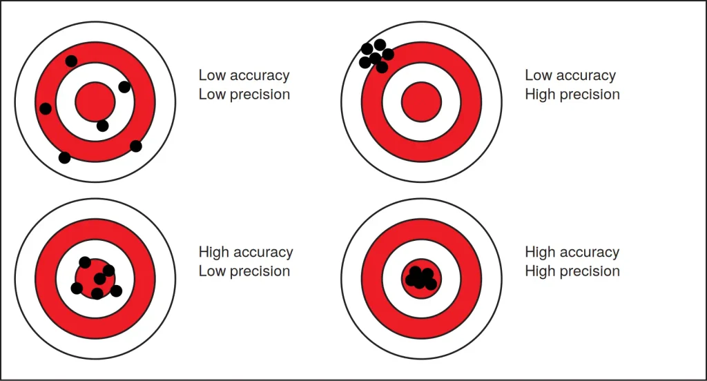
Precision describes how closely repeated measurements agree. Accuracy describes how closely those measurements represent the correct position.
A GNSS receiver can repeatedly produce nearly identical coordinates. A scanner can create an incredibly detailed point cloud. But if the control, datum, setup or methodology is wrong, all of those measurements can agree with each other and still be wrong.
We can be precisely wrong.
More Data Does Not Automatically Mean Better Data
A traditional survey crew might have collected hundreds or thousands of carefully selected points. Modern LiDAR can collect hundreds of millions. That increase in data density is extraordinary — but more points do not automatically create more accuracy.
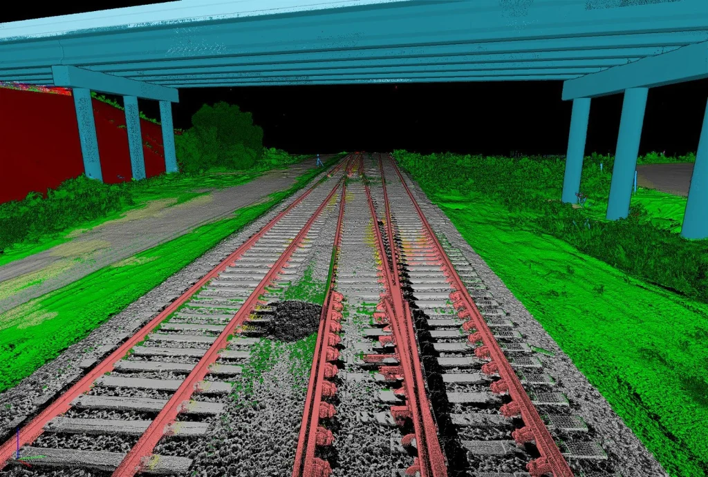
A survey-grade digital twin can preserve the measurable three-dimensional relationship between infrastructure, terrain and surrounding features.
A billion points tied to poor control can still produce a poor survey.
Technology allows us to collect more information, faster and in extraordinary detail. It does not eliminate the need to verify that information.
What We Need to Pass Along
The old surveys, photographs and field books from the analog years are valuable for more than nostalgia. They remind us of the fundamentals previous generations taught us: measurement, control, evidence, redundancy, accuracy, documentation and professional judgment.
Young surveyors should embrace GNSS, LiDAR, scanning, drones, GIS, digital twins and artificial intelligence. But they also need to understand what is happening behind the technology, because today’s advanced technology will eventually be replaced by something even better.
In 1979, we represented the three-dimensional world with carefully measured points, elevations, contours, lines and notes on paper. Today, we can represent that same world with hundreds of millions of XYZ points in a survey-grade digital twin.
The instruments changed. The amount of data changed. The way we visualize our work changed.
But control still matters. Evidence still matters. Accuracy still matters. Checks still matter. And professional judgment still matters.
The technology changed. The fundamentals didn’t.
Robert L. Young, RPLS 5400 • Trans Texas Surveying & Mapping
GIS — Get It Surveyed™ | A Robert L. Young Educational and Book Series
© 2026 Robert L. Young. All rights reserved. Reproduction or distribution requires written permission, except as permitted by law.