
The right level of accuracy depends on the decision
One of the questions I have heard throughout my surveying career is, “How accurate is it?”
My first response should be, “Accurate for what?”
That is not a way to avoid the question. It is the question that must be answered before anyone can make a responsible decision about the data. A location that is perfectly useful for finding a restaurant may be completely unsuitable for setting a bridge column. An aerial photograph may show the general relationship between a house and a parcel, but the photograph does not establish the boundary. A utility symbol may be adequate for an inventory map but not for excavation or design.
In Article 5, I explained that a map can be right and still not be accurate enough. That principle is the starting point. The next step—and the purpose of this article—is to turn the intended use into a defensible requirement: what must be measured, how well it must be known, how it will be checked and what the next user must be told.
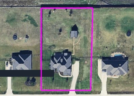
Figure 1. The aerial image provides visual context. The magenta outline represents boundary geometry derived from a TTSM ground survey. The aerial photograph itself does not establish the boundary. Each layer must be understood according to its source, reference and intended use. Source: Trans Texas Surveying & Mapping (location label redacted).
CENTRAL IDEA: Accuracy is not merely a number attached to a dataset. It is a requirement that must be defined, tested, documented and connected to the decision being made.
Start With the Decision
Too often, the discussion begins with equipment: Which receiver was used? How many points were collected? Was the image captured by a drone? Those questions matter, but they come later. The responsible sequence begins with the decision the information must support.
If the task is public communication, a clear approximate location may be enough. If the task is planning, the important relationship may be whether an asset is on the north or south side of a roadway. If the task is design, elevation and the relationship among features may be more important than a visually perfect basemap. If the task involves construction, a boundary, an easement, ownership or public safety, the required evidence and verification become much more demanding.
The word accuracy can also hide several different questions. Are we concerned about horizontal position, elevation or both? Do nearby features need to fit each other closely even if the entire dataset is shifted? Must the work agree with an external coordinate system? Is repeatability important? How current and complete must the information be? A single label such as “high accuracy” does not answer those questions.
Define the Requirement Before Choosing the Method
I use five questions to move the conversation from a vague request to a defensible scope:
- The decision: What will someone approve, design, build, buy, sell or maintain with this information?
- The consequence: What can happen if the position, elevation or relationship is wrong?
- The measurement: Which features and dimensions must actually be known, and which can remain approximate?
- The verification: What control and independent checks will demonstrate that the result meets the need?
- The record: What source, date, coordinate reference, method, limitations and intended use must follow the data?
These scope questions put the five questions I ask about GIS information into practice: Where did it come from? How accurate is it? What is it referenced to? Can it be independently verified? Is it accurate enough for the decision at hand? The decision and its consequences establish the accuracy required. The measurements and independent checks help determine whether that requirement was met. The documentation preserves where the information came from, what it is referenced to and what it can reliably support.
Only after those questions are answered should we select the collection method. Sometimes existing GIS information is appropriate. Sometimes a current aerial image, a field inventory or a handheld observation is enough. Sometimes the answer requires GNSS, a total station, levels, terrestrial scanning, aerial LiDAR or a combination of methods tied to surveyed control. The technology should follow the requirement—not define it after the work is finished.
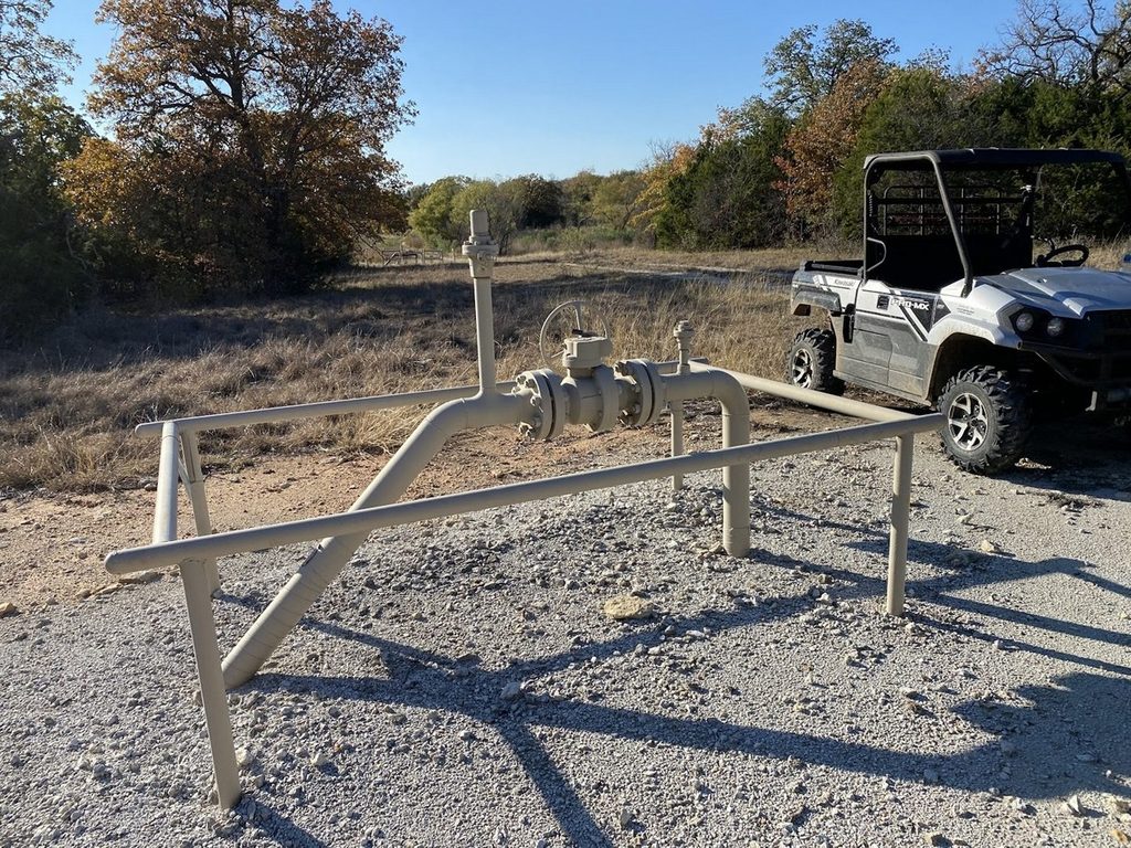
Figure 2. A pipeline facility can support different decisions. A general location may be sufficient for an inventory; design, construction and conflict analysis require measured relationships, appropriate control and documented checks. Source: TTSM field photograph; site not identified.
Precision Can Fool Us
Modern software displays long coordinate values and elevations to several decimal places. That appearance of precision can be persuasive. But the number of digits shown on the screen does not prove the quality of the position. A receiver can repeatedly report nearly the same value and still be tied to the wrong datum, the wrong localization, an assumed point, an incorrect antenna height or an inherited control error.
Precision describes how closely repeated measurements agree with one another. Accuracy describes how closely the result agrees with an accepted reference appropriate to the work. We need both, but they are not interchangeable. A tight cluster in the wrong place is still wrong.
The same warning applies to visual quality. Smooth contours, crisp imagery and dense point clouds may be useful and impressive, but appearance is not a test. A dependable result must be supported by a known reference, a suitable procedure and evidence that the procedure worked.
Control and Verification Are Different Jobs
Control holds the work in place. Depending on the project, it may establish the horizontal and vertical reference, connect multiple collection methods or allow future work to reproduce the same framework. Good control is essential, but control alone does not prove that every observation, feature code, surface or deliverable is correct.
Verification asks a different question: Did the completed work perform as intended? An independent checkpoint is valuable because it is not merely another calculation made from the same assumptions. Field comparisons, redundant observations, level loops, closures, target residuals, surface checks and reasonableness reviews can all contribute, depending on the job. The check must be capable of revealing the kind of mistake that matters to the decision.
This is where professional judgment remains essential. No single check answers every question. A horizontal checkpoint may say little about vertical quality. A good registration residual may not prove that a scan is correctly tied to project control. Agreement among nearby points does not establish the legal location of a boundary. The surveyor must understand what was tested—and what was not.
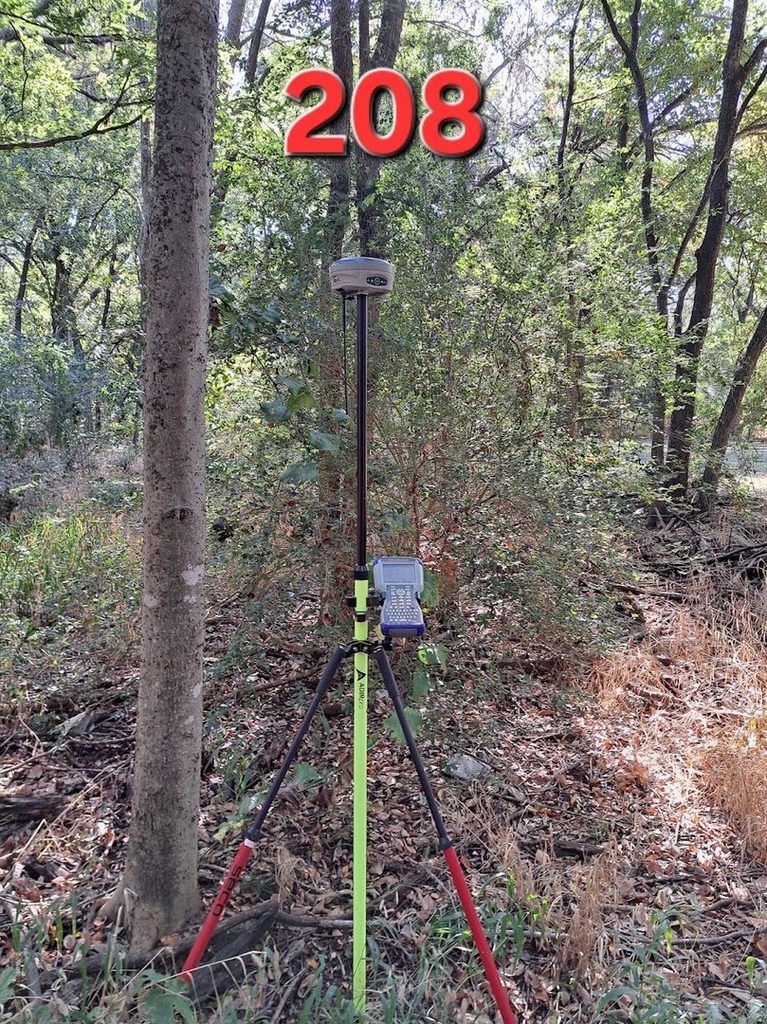
Figure 3. A GNSS receiver set up beneath tree cover at a point labeled 208. The label alone does not show whether this observation was project control, a check or a surveyed detail. Its purpose, reference and verification must be documented. Source: TTSM field photograph.
Mixed Accuracy Is Normal—Unknown Accuracy Is the Problem
A practical GIS often contains information collected at different times, by different people and for different purposes. An aerial image, approximate utility inventory, survey-derived boundary, controlled topographic survey and construction record may all appear in one system. That mixture is not automatically a failure. It becomes dangerous when every layer is treated as though it has the same authority, currency and positional quality.
The goal should not be to make every feature survey-grade. That would be unnecessary and unaffordable for many systems. The goal is to identify which information supports which decisions, preserve the distinctions among the layers and improve the data where the consequence justifies the effort.
That approach also helps control cost. We can spend the most effort where error carries the greatest consequence, use fit-for-purpose methods elsewhere and avoid creating a false promise that the entire map is equally precise. A well-managed GIS tells the truth about its own limitations.
Metadata Is Part of the Measurement
A coordinate without context is incomplete. The value becomes more useful when the next person can determine where it came from, when it was collected, the coordinate system and datum, the units, the equipment or source, the procedure, the checks, the responsible party and the intended use.
This does not require a long technical report for every GIS feature. It does require enough documentation to keep the data from being used beyond what it can support. Useful metadata can be as simple as a source field, collection date, method, quality category and limitation note—provided the terms are defined and consistently applied.
Documentation also protects the investment. Staff members change. Files move. Equipment is replaced. Years later, the person using the information may not know why a line was drawn or which control held it in place. Good metadata carries the reasoning forward when the original surveyor or technician is no longer available to explain it.
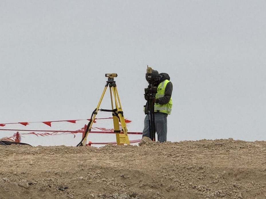
Figure 4. Construction measurements must be referenced, checked and appropriate to the tolerances and consequences of the work. The decision being supported—not simply the instrument being used—governs the measurement and verification process. Source: TTSM field photograph; project not identified.
Ask Better Questions
When someone asks, “How accurate is it?” I want the conversation to continue. What decision is being made? Which kind of accuracy matters? What holds the data in place? How was it independently checked? What will the next user know about its source and limitations? Those questions lead to better scopes, better budgets and safer decisions.
Sometimes the answer is that the existing GIS information is entirely adequate. Sometimes it needs to be updated, measured more carefully or documented more honestly. And when the consequence demands a defensible position, elevation or relationship, the answer is straightforward: define the requirement, establish control, check the result—and get it surveyed.
Robert L. Young, RPLS 5400 • Trans Texas Surveying & Mapping • www.transtx.com
GIS — Get It Surveyed™ | A Robert L. Young Educational and Book Series
© 2026 Robert L. Young. All rights reserved. Reproduction or distribution requires written permission, except as permitted by law.