

One of the easiest mistakes to make with geospatial information is to assume that because something looks right on a computer screen, it must be right on the ground.
Google Earth is an extraordinary tool. GIS is an extraordinary tool. Professional surveying is another extraordinary tool. But they answer different questions.
A recent Trans Texas project in Glen Rose, Texas, provides a good example of how these tools can work together.
Where Is It?
We started with Google Earth. The aerial image immediately answered the first question: Where is the property?
The subject property could be viewed in relation to Texas Drive, surrounding development, nearby roads, Wheeler Branch Reservoir and the larger Glen Rose area.
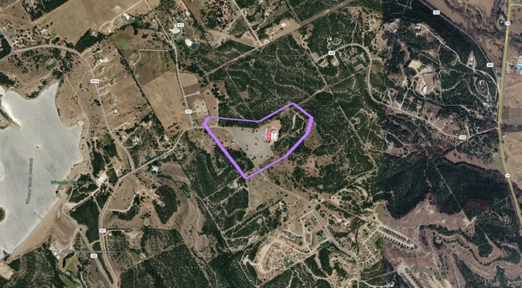
Figure 1. Google Earth provides immediate geographic context: where the property is and what surrounds it.
For many purposes, that may be all the information someone needs. But our question went further.
What Do We Know About It?
The next Google Earth image looks considerably different. Now there are colored lines, labels and references to recorded documents.
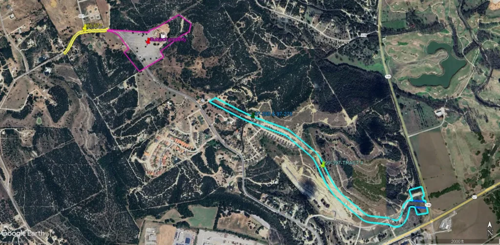
Figure 2. Record deeds and easements organized geographically in Google Earth help visualize how the documentary pieces may relate.
This is where GIS-type thinking becomes extremely valuable. Different deeds, tracts and easements can be organized geographically and viewed together. Documents that may be difficult to visualize from written descriptions begin to make sense spatially.
Putting a deed line on Google Earth does not make it a surveyed boundary.
The display helps us investigate the property, understand relationships, and determine where additional research or field investigation may be needed. It does not replace that investigation.
Now We Have to Get It Surveyed
The assignment ultimately required determining the boundary of a 25.92-acre tract and documenting the improvements and other conditions affecting the property.
That required leaving the computer screen and going to the ground.
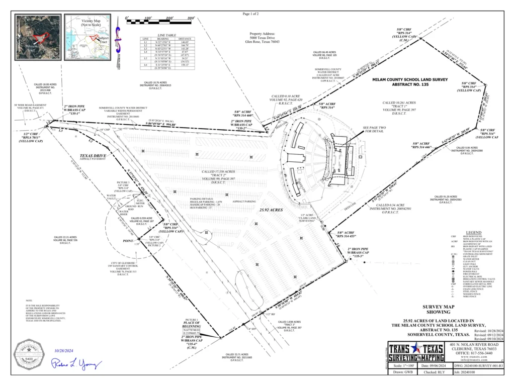
Figure 3. The professional survey documents the 25.92-acre tract with monuments, bearings, distances, adjoining record tracts, easements, improvements and a defined place of beginning.
The survey was performed on the ground during multiple days in August 2024. Its bearings were correlated to the Texas State Plane Coordinate System, North Central Zone (4202), NAD83 (2011). The survey notes also identify the vertical reference as NAVD88 using GEOID18.
What is it referenced to?
Those details may seem technical, but they matter when information from different sources must work together.
The Picture Didn’t Become Wrong
Nothing about performing the survey suddenly made Google Earth a bad tool. Google Earth was doing exactly what we needed it to do: it showed us the property in its geographic context.
The record information helped us understand the documentary pieces that needed to be investigated. The professional survey answered the more demanding questions involving boundary, monuments, measurements, easements, improvements and positional relationships.
The tool didn’t become wrong. The question changed.
Put Them Together
Now look at what happens when the surveyed information is placed over aerial imagery.
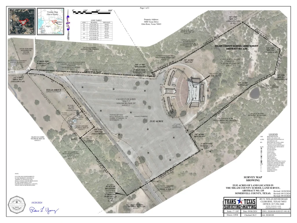
Figure 4. Surveyed boundary, improvements and record information combined with aerial imagery: geographic context and professional survey information in one presentation.
The aerial photograph provides immediate visual understanding. The survey provides measured and documented relationships based upon the professional survey. Together they can communicate more than either could communicate alone.
Different Questions Require Different Answers
If someone asks, “Where is this property?” Google Earth may provide an excellent answer.
If the question is, “What deeds, easements, utilities, flood information or other geographic information may affect it?” GIS can become an extraordinarily powerful tool.
But if the question becomes, “Where is the boundary? Where is the easement? What monument controls this corner? What coordinate system is this referenced to? Where is this improvement in relation to the property line?” we have moved into a different kind of question.
That is where professional surveying becomes important.
And when we combine properly controlled surveying with GIS, aerial imagery, LiDAR, point clouds and the other geospatial technologies available today, the result can be far more useful than arguing about which technology is better.
Where did this information come from?
How accurate is it?
What is it referenced to?
Can it be independently verified?
Is it accurate enough for the decision I am about to make?
That is why GIS and professional surveying belong together.
Robert L. Young, RPLS 5400 • Trans Texas Surveying & Mapping
GIS — Get It Surveyed™ | A Robert L. Young Educational and Book Series
© 2026 Robert L. Young. All rights reserved. Reproduction or distribution requires written permission, except as permitted by law.